

Where is Bali on a map? Where is Bali located in Indonesia?
This article will bring into focus where is Bali on a map.
Table of Contents Show
Where is Bali on a map?
Bali is an island in the country of Indonesia.
We have a detailed guide on where is Bali located which will tell you heaps about Bali and its location.
In this article, we’re going to detail where Bali is on a map so you can get oriented. Here’s a quick look using Google Earth:
It's no surprise that people ask where Bali is on the map, because Bali is a small island, so it’s hard to find.
In fact, Bali is only one of the 18,307 islands that make up the country called Indonesia (source).
So, Bali can be hard to spot on a map of Indonesia, let alone the whole world!
Fascinated? You might also like to read about: Is Bali in Indonesia? and Is Bali in east Asia?

Where is Bali located in Indonesia?
Below is a map that shows all of Indonesia.
Bali is a small island to the right (east) of the big island of Java. Bali’s capital city is Denpasar.
Use the + button on the map to zoom in and find Bali.
Can you find it?
Now you can see Bali is located between the Indonesian island of Java to the west and the island of Lombok to the east.
Have a play with this map and zoom in and out.
Below is an infographic map that shows how small Bali is compared to the other large islands around it.
Bali is number 4 on the map—it's small, right?

Bali is number 4 on this map of Indonesia | Map Credit: Freepick
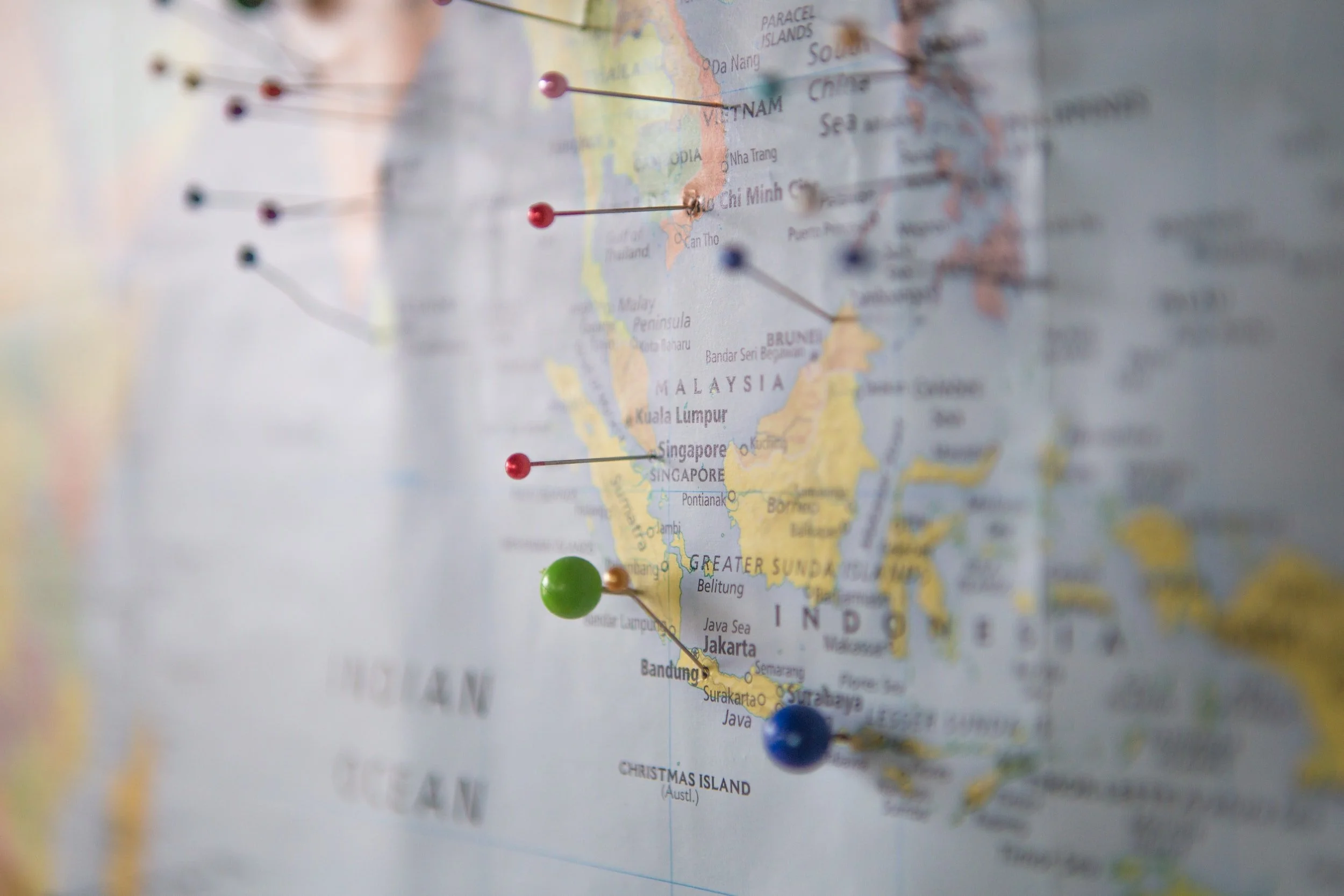
Where is Bali on a world map?
So now we know where Bali is located within Indonesia, but where is Bali on a world map?
Bali is located on a world map in Southeast Asia.
Specifically, it is situated in the Indonesian archipelago, which spans between the Indian Ocean and the Pacific Ocean.
First, here is Indonesia, shaded in red, on a world map:
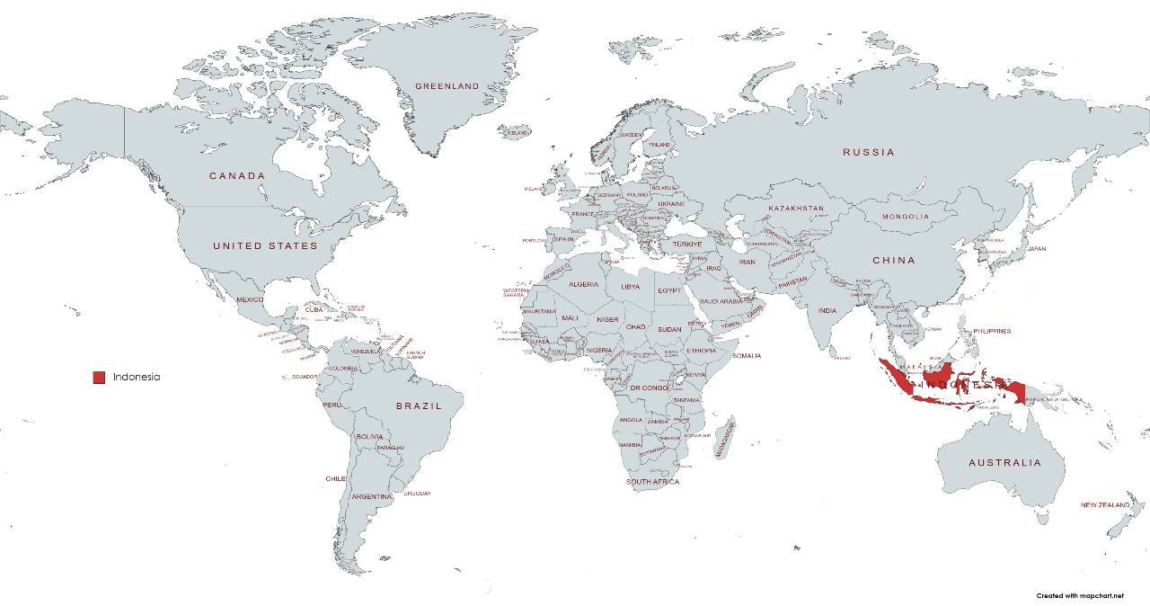
Indonesia is shaded red on this map, and as you can see, it is just north of Australia
Bali is surrounded by Malaysia, the Philippines, Papua New Guinea and Australia.
And if we look closely, we can see the tiny island of Bali in red, on this map of Indonesia:
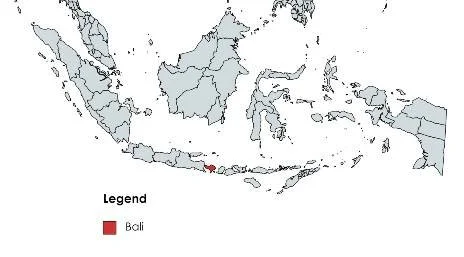
Can you spot the tiny red dot? That is the island of Bali
Bali is positioned to the east of Java, one of Indonesia's main islands, and to the west of Lombok.
When looking at a world map, you can find Bali as a relatively small island within the larger Indonesian territory, which consists of thousands of islands spread across the equator.
What is the equator?
The equator is an imaginary line that circles the Earth's surface, dividing it into the Northern Hemisphere and the Southern Hemisphere. It is an essential reference point used in geography and cartography.
The equator is located exactly halfway between the North Pole and the South Pole, creating a latitude of 0 degrees. It is the longest line of latitude, stretching approximately 40,075 kilometers (24,901 miles) around the Earth's circumference.
The equator experiences the most direct sunlight throughout the year, resulting in a generally warm climate in regions near this line. It serves as a fundamental reference for understanding the Earth's geography, climate patterns, and navigation systems.
Where is Bali located relative to the equator?
Bali is located at a latitude of approximately 8 degrees south of the equator.
Is Bali in the southern hemisphere?
Because Bali is south of the equator, this places it in the southern hemisphere.
And being close to the equator, Bali experiences a tropical climate with relatively consistent temperatures throughout the year.
Is Bali part of ASEAN?
ASIAN is the Association of Southeast Asian Nations.
ASEAN is a regional bloc consisting of ten members: Brunei, Cambodia, Indonesia, Laos, Malaysia, Myanmar, the Philippines, Singapore, Thailand, and Vietnam.
The primary objective of this association is to enhance economic and security collaboration within the region.
Bali is an island in the country of Indonesia, which in turn is a member of ASEAN.
Here is a map that shows all the ASEAN countries and where they are located:

Bali is an island in the country of Indonesia. Indonesia is a member of ASEAN
Religion and where Bali is in relation to India
The origin of Bali’s Hindu-based religion is India, so it’s interesting to see where Bali is in relation to India on a map. Indian merchants came to Bali as early as the 1st century CE and they obviously would have come by boat. They brought Hinduism with them, and this was blended with the animism of the original Bali inhabitants, the Bali Aga, to form a style of Hinduism unique to Bali.
Bali is situated in the Indian Ocean, just like India. Nevertheless, the province of Bali in Indonesia is positioned in close proximity to the Pacific Ocean. So, when embarking on your journey from India, you will head towards the southeast in order to reach Bali. The overall distance from India to Bali amounts to approximately 5,000 kilometers, and the flight from Delhi, for example, takes approximately 9 hours.
What a map can tell us about Bali’s weather and seasons
By looking at a map, it is not possible to determine the exact weather seasons in Bali. However, you can get some hints.
Bali is located near the equator, so you can expect it to be hot with high humidity. And as you can see on a map, it is in an exposed location, so it’s going to get winds and rough weather at times from the Indian and Pacific Oceans.
Bali generally experiences two main seasons: the dry season and the wet season. These seasons are influenced by the monsoon patterns in the region.
The dry season typically occurs from April to September, while the wet season typically lasts from October to March. During the dry season, you can expect less rainfall and lower humidity, along with warm and sunny weather. This period is considered the peak tourist season in Bali.
On the other hand, the wet season is characterized by higher rainfall and increased humidity. Although it may rain frequently during this time, the showers are often short-lived and followed by periods of sunshine. The wet season also coincides with the lower tourist season in Bali.
Interestingly, if you look at a satellite map of North Bali, you can see it is a dryer region compared to South Bali. The north slopes of Bali’s volcanoes are particularly dry. In fact, North Bali regularly experiences drought, and the Balinese in those areas often struggle to feed themselves and grow economic crops.
Other articles on where Bali is
You might like to check out our other articles about Bali’s location:
Discover more Bali travel tips


Discover everything you need to know about Bali's new tourism tax before your next visit to this tropical paradise.